
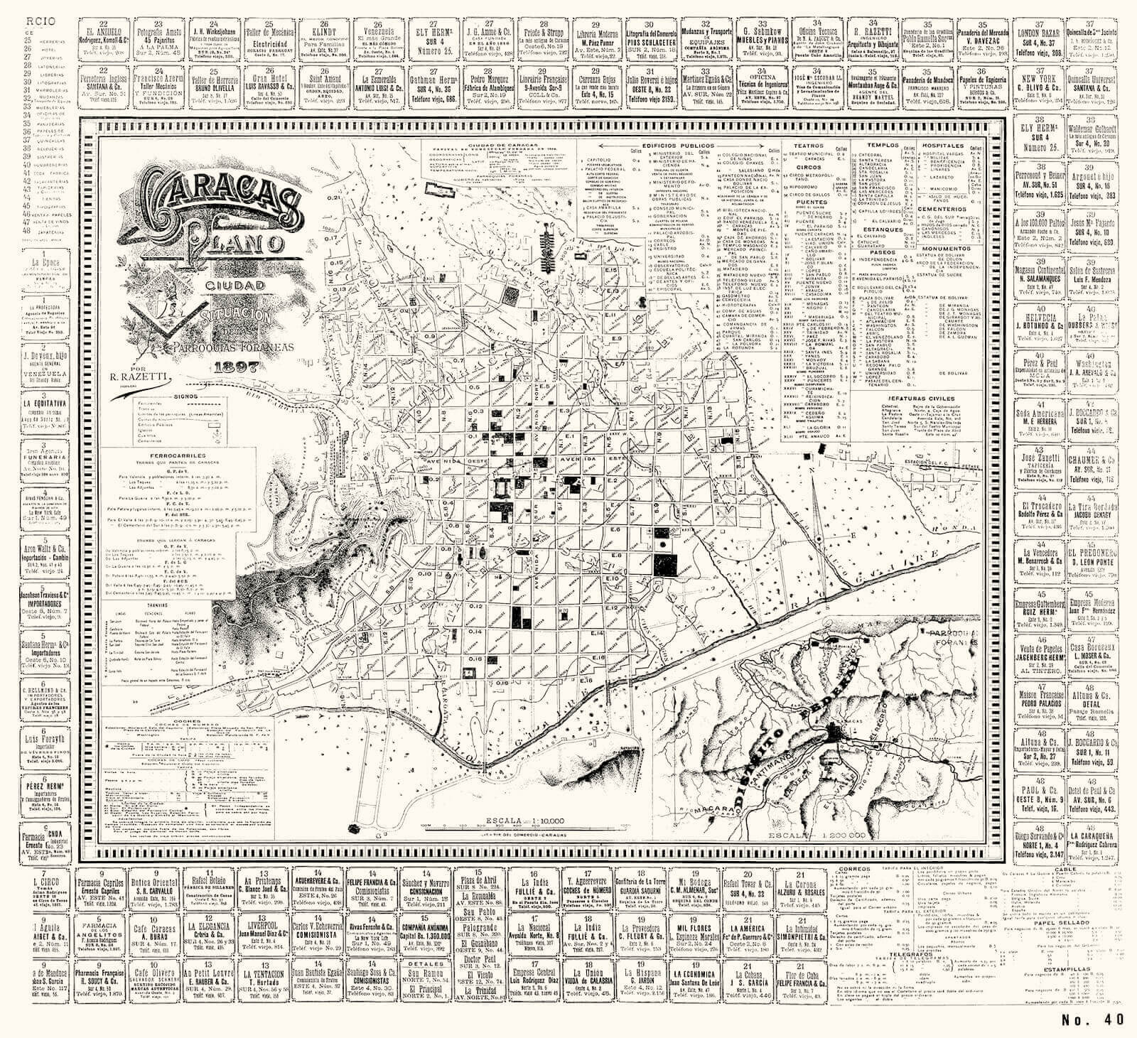
City map and foreign parishes. Ricardo Razzetti, Caracas, 1897.

Ricardo Razetti
Following a historical sequence this segment should have been titled The City of Gómez’s system. Juan Vicente Gómez ruled Venezuela with an iron fist, through a cruel and sleepy
dictatorship from 1908 until his death in 1936. We do not talk about Gómez’s City because the dictator paid little attention to the capital. He preferred Maracay, and thus very few changes were made in Caracas save for those urban changes that the demographical pressure made unavoidable. During a big portion of the long years that this stalling in city growth lasted Ricardo Razetti dedicated himself to tell our story in precise urban Images.
If we had to choose for this brief retelling the best example of the different tasks and necessary passion that requires providing a city with an image of itself, Ricardo Razetti would be proposed without a doubt, who made seven plans of Caracas from 1897 and 1929.
Razetti does not only represent what exists, he also participates building, urbanizing and introducing changes in the ordinances recompiled by the Laws of Indies that had remained in force since the colony.
Martin Padrón in his essay Caracas 1928-1958: Remains and morphological transformations during the first modern Urban-Architecture era in Venezuela tells us that Razetti made in 1889 an ordinances project where the alignment of the urban block is recognized and respected, a heritage that «could not be forsaken save in the most urgent cases out of necessity and only when public utility so demanded». «It is not a coincidence», writes Padrón «that Razetti’s Plans besides having topographical fidelity, express their interest in valuing public spaces». Said plans are surrounded by notes highlighting the location of walks, squares and public gardens as well as the most relevant buildings, something showing us his interest in highlighting the value of unoccupied spaces in the city.
Urban legislation existing at this date was adopted for the city of the checkerboard, of the alignment. Padrón insists on the
subject by commenting The Urban and Rural Police Ordinances, adopted in April 19th 1910, exactly 100 years after the Independence. This legal body was the first update of the Ordinances for Police and Government of the highly illustrious city of Santiago de León de Caracas drafted by Miguel José Sanz between 1794 and 1804. In these ordinances of 1910 we may feel the influence of that proposed by Razetti in 1898 because they establish that new construction should respect «the legal alignment of streets» and in comparing to other buildings on the street should avoid producing «a deformity of the public aspect».
In the ordinance about Urban and Rural police adopted in 1926, also influenced by Razetti’s ideas it is provided that «Any building will not be raised, be it public or otherwise, if the front of such building is not positioned so that the streets from end to end are connected by a straight line». Article 106 contemplates some exceptions: «Buildings will be allowed to be separated from the streets only when the space between them is occupied by some fences, or surrounded by pillars or filled with a Garden, in which case the whole length must be fenced». It should be noted that current ordinances forces buildings away from the streets while the ones in 1926 conditioned such separation on the continuity that buildings fronts gave the street.
Razetti’s work in XIX and XX centuries help preserve and comprehend the Urban legacy that colonial and republican Caracas would leave for a city that would soon expand beyond the Guaire and the Anauco stream, reaching as far as El Valle, Sabana Grande and Chacao, and thus going from a single urban setting to multiple ones in many different neighborhoods.
Anatomy and physiology of the city
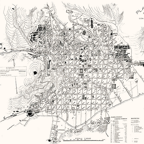
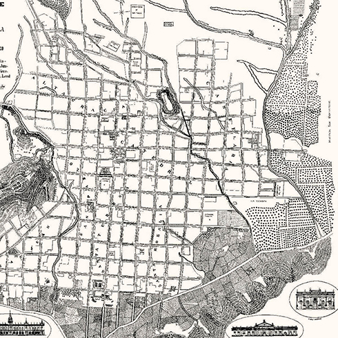
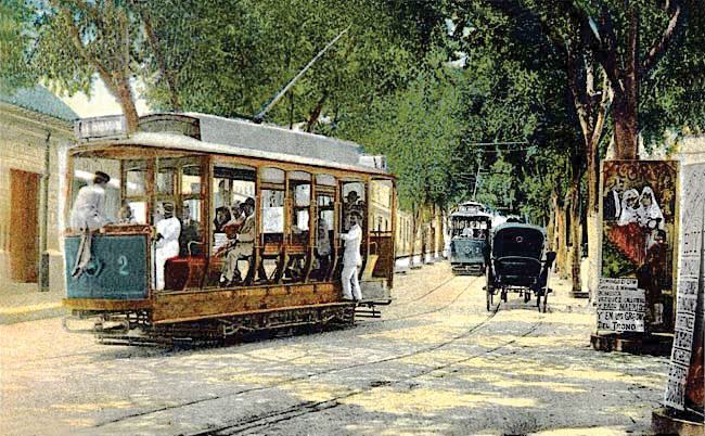
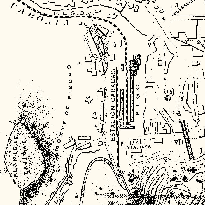
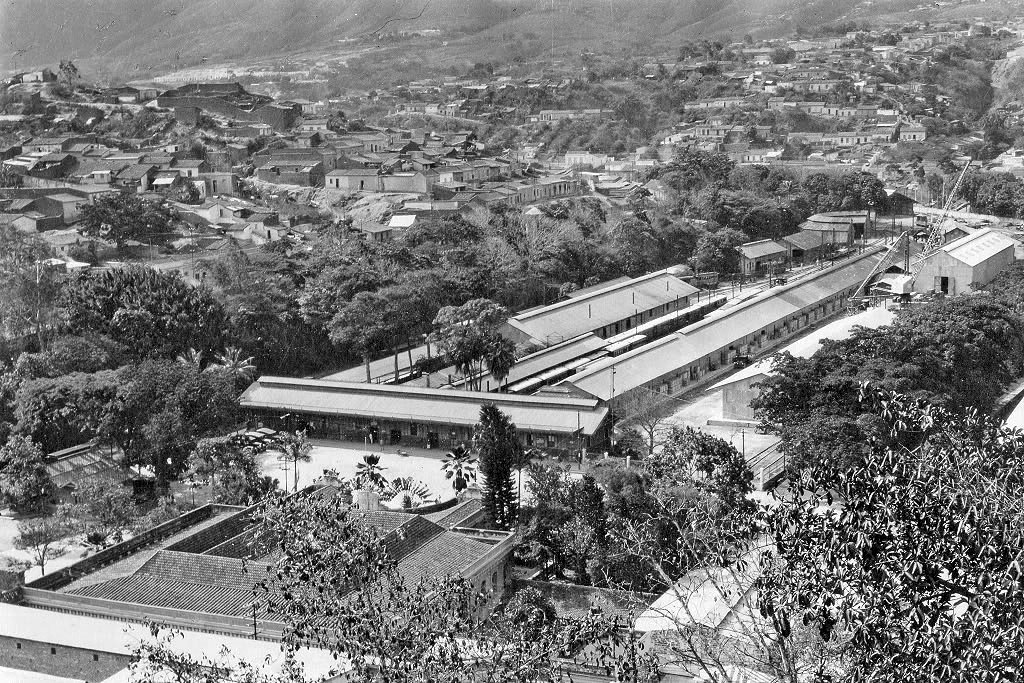
In 1897, Razetti´s first map presents both an urban form as many of its functions, anatomy and physiology of Caracas, including both measures of their spaces and their times. The routes and timetables of trains to Valencia, La Guaira, Petare and to El Valle and El Cementerio and tram systems (Bolívar Tram and Caracas Tram), luxury numbered wagons included (depending on the horse), systems and rates of mail and telegraph. The transport and communication networks have gained enormous importance and soon not only be in the service of the city, but determine its dynamics and growth form.
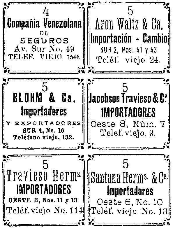
What catches the attention of this map are its edges, where small boxes that advertise commercial establishments with their address and phone number shown. I guess these ads financed the execution and printing of this map, showing Caracas, not as a political and cultural entity proposed by Guzmán Blanco, but as a kind of big mall. Razetti presents 158 commercial establishments organized into 48 types of trade (including from confectioneries to funeral homes), and places distributed according to the method proposed by Cristóbal Rojas, four avenues that start from Plaza Bolívar. Thus we have «La Compañía Venezolana de Seguros,» a type 4 commerce is in the Avenida Sur, number 16, phone 1546. Caraqueños continued to be guided by the traditional corners system (whose names are also included in the plan) in this city that keeps its multifunctionality and still extraordinary uniformity.
Also the quality held by Padrón, his interest in public space and architecture is also present. In this sheet the location of over 60 notable buildings and more than 20 public spaces shown as «Paseos» is given. This description suggests that Razetti´s public spaces should operate as a system of paths and not as isolated entities.
In the right corner of the sheet we see an «annex plan of Caracas situation regarding Federal District 1:20,000 scale.» That double vision of the city and the province of Venezuela featuring the 1578 map begins to emerge again, as the city, rather than an entity with boundaries, is an organization that wants and needs to expand.
HC-31
HC-35
HC-34
HC-34
HC-32