Zone 9 The Ávila

«Caracas’ “laid down” Central Park…»
William Niño Araque
The Ávila Mountain, Waraira Repano National Park, which in native language means «big mountain», between the sea (at level zero) and the valley (between 900 and 1000 masl), with two fronts -north toward the Caribbean, south toward the capital- lies from west to east like a huge green resting animal (85,192 ha). It has witnessed adventurers who undertook the conquest of the land; pirates who deciphered the mysteries of its roads to find a Caracas of primitive huts and humble peasants; later, eminent geographers and naturalists from other latitudes imagined its treasures. Travelers, poets and painters have also left their mark, inspired by its sun-colored variant foliage and its nocturnal silhouette, confirming it as «the emblem» of the city of Caracas, as the line that divides the horizon for the caraqueños, the fixed framework of all that is built, the wrapping of all the senses.
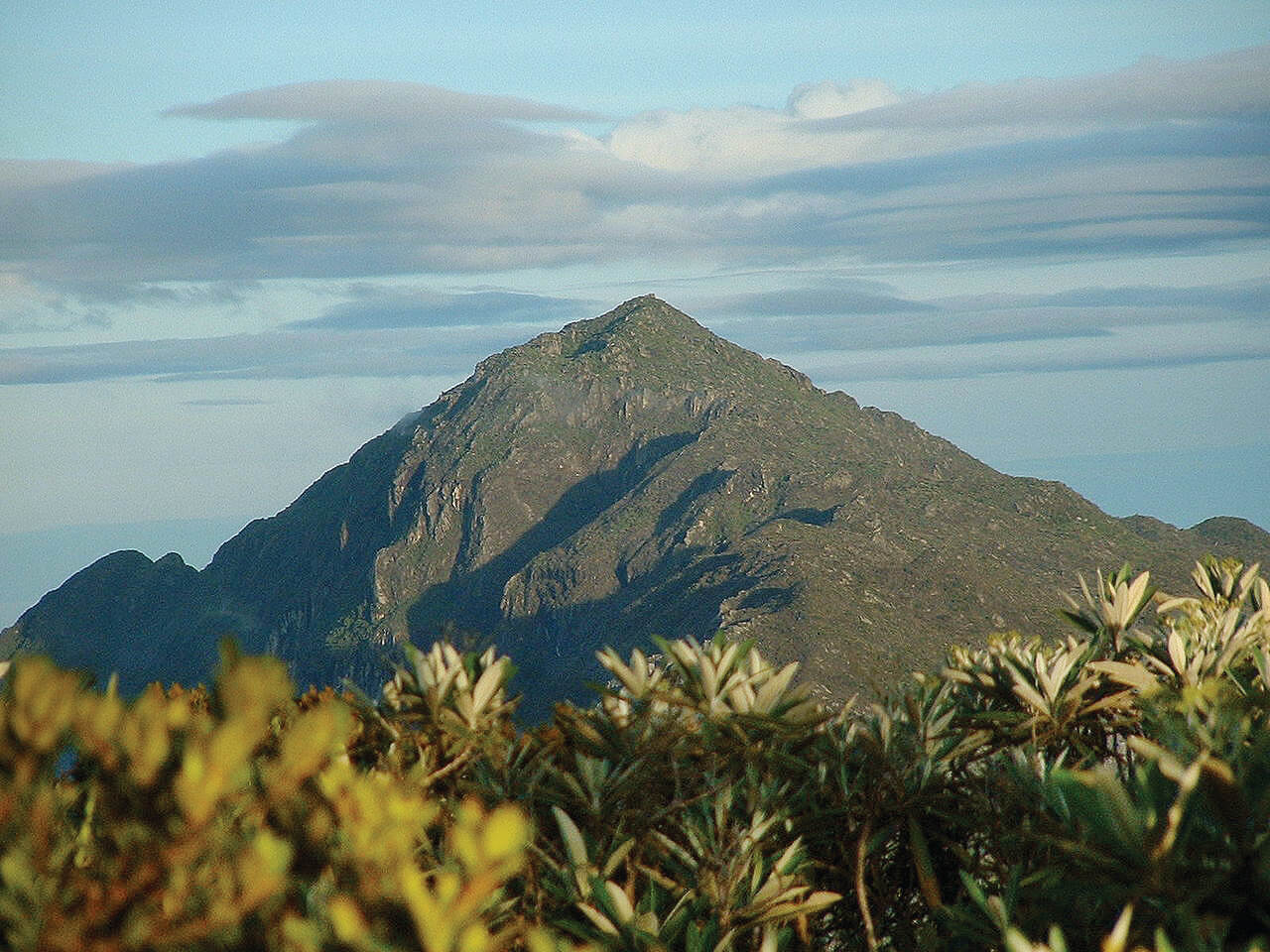
Its vegetation varies with the altitude, which reaches its high point on Naiguatá Peak (2765 masl): the rather sparse mountain shrub vegetation; the rainforest with tall leafy specimens, until reaching the savannah grasslands at the edge of the city. On the side facing the sea, between both forests there is other vegetation due to the years of coffee planting. Next to the sea there are thorn bushes and cacti. There is wildlife to be seen: squirrels, opossums, armadillos, over 200 species of birds. In its forests there are tapirs, pumas, jaguars, porcupines, pacas, deer, howler monkeys and a variety of snakes.
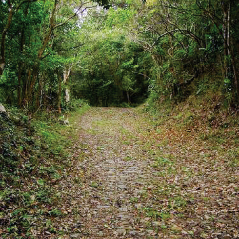
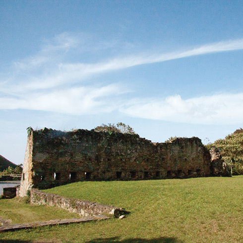
The Way of the Spaniards, paved in 1762, still preserves some parts of its route of rounded cobblestones (access is from La Puerta, La Pastora). The ruins of Guayabal, Corozal and Torquemada haciendas are also standing, as well as La Venta inn, to which Humboldt refers in his chronicles. The protection of La Guaira, Venezuela’s first port, from the siege of pirates and buccaneers, required the construction of a defensive system consisting of El Salto fort, San Carlos castle, San Joaquín de la Cumbre castle and the military bases of La Atalaya and the Black castle (according to Graziano Gasparini). Some of these castles were restored in the eighties.
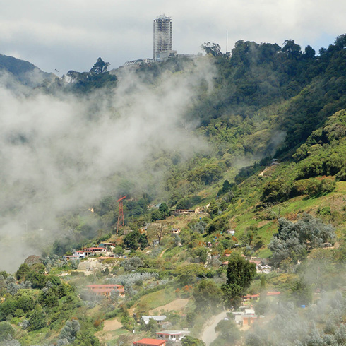
On the south slope there are several pedestrian accesses for daily routine hikers and climbers from the city along Avenida Boyacá or Cota Mil: El Polvorín, Llano Grande, Loma del Viento-San Bernardino, Chacaíto, Altamira-Sabas Nieves, Pajaritos, Sebucán, Cachimbo, Estribo de Duarte-Boleíta, La Julia, Galindo, Universidad Metropolitana and Ayala. From Llano Grande to the west to beyond Ayala to the east, all the paths are strung through the firebreak located between the 1000 and 1300 m levels and that crosses the city almost horizontally from one end to the other, overhanging the mountain foothills that plunge into the road that winds around it, Avenida Cota Mil, limiting what is built up in the city, and uses viaducts -especially high ones through Los Chorros Park- to maintain continuity from Terrazas del Ávila to the east to La Pastora, where there are currently building a connection to the Caracas-La Guaira highway via tunnels.
There is a cable car system with stations in Caracas and the Vargas state coast. From Maripérez station you go up to Ávila Station and in the mountain you can get to San Francisco de Galipán and San José de Galipán by road. The cable car segment going down to the coast has been paralyzed since 1977. Going down Fila Maestra toward the coast, a temperate climate area opens up, with extensive cultivation of flowers and fruit trees. It was inhabited by the descendants of the first settlers that arrived from the Canary Islands in the eighteenth century and is one of the main suppliers of flowers in the metropolitan area. Its population has grown with vacation homes of city dwellers, inns and gourmet restaurants, which take advantage of the spectacular views.
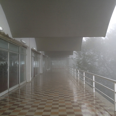
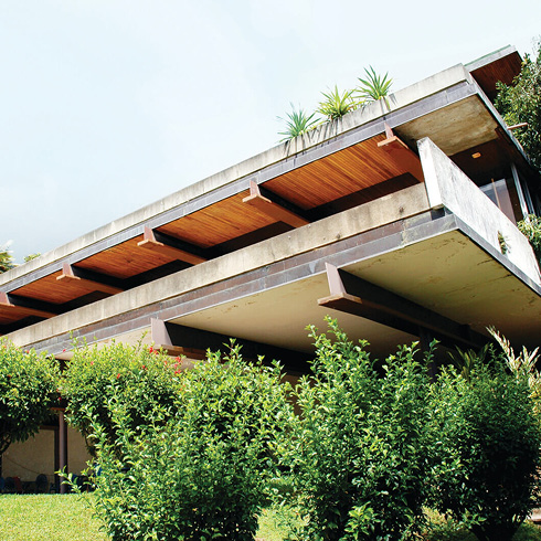
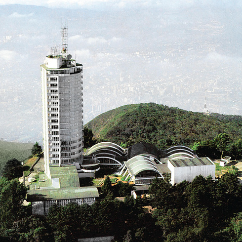
Toward the Ávila Peak is the Hotel Humboldt (2250 masl), an outstanding example of modern Venezuelan architecture (Tomás Sanabria, 1956) and a symbol of the city. Lagunazo Peak (2225 masl), Occidental Peak (2478 masl), La Silla (23 08 masl), Oriental Peak (2640 masl) and, further away, Naiguatá Peak (2765 masl) can be seen, and are part of the hikers’ itineraries. Los Venados, one of the most visited places, where the park’s administrative offices function, with road access from Cotiza, provides an unforgettable experience with the views that can be seen from the road’s slopes towards the slab buildings of Pinto Salinas and the various views of the city with its topographical differences.
Forest fires occur during drought periods. For that reason, a system of ponds and water reservoirs, at one time designed in network for this eventuality, are awaiting reactivation and maintenance, as well as systems of volunteer rescue groups.
Only a minor portion of the mountain on its south face coincides with the valley of San Francisco in the capital, Caracas. This makes certain peaks frame it: Topo Infiernito, El Ávila, Occidental Peak, Oriental Peak and Naiguatá Peak. The mountain’s north face, bordering the Vargas state coast, is considered an extension of the capital because of its uses and proximity: Catia La Mar, La Guaira, Macuto, Caraballeda and Naiguatá. And fur
ther on, the coastal landscapes of Los Caracas, Osma, Todasana, La Sabana, Caruao and Chuspa, connecting in a circuit to Higuerote, to enter back into the capital.
El Ávila dentro de la cordillera de la costa. EA-01
Cortafuego EA-09
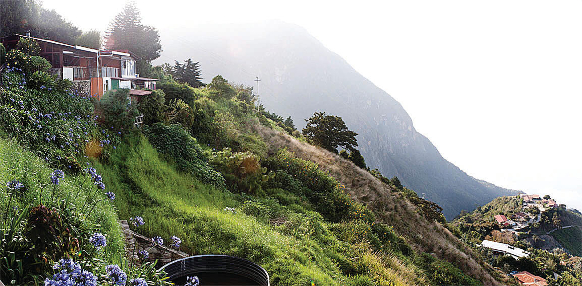
Vista hacia el poblado de Galipán. EA-04
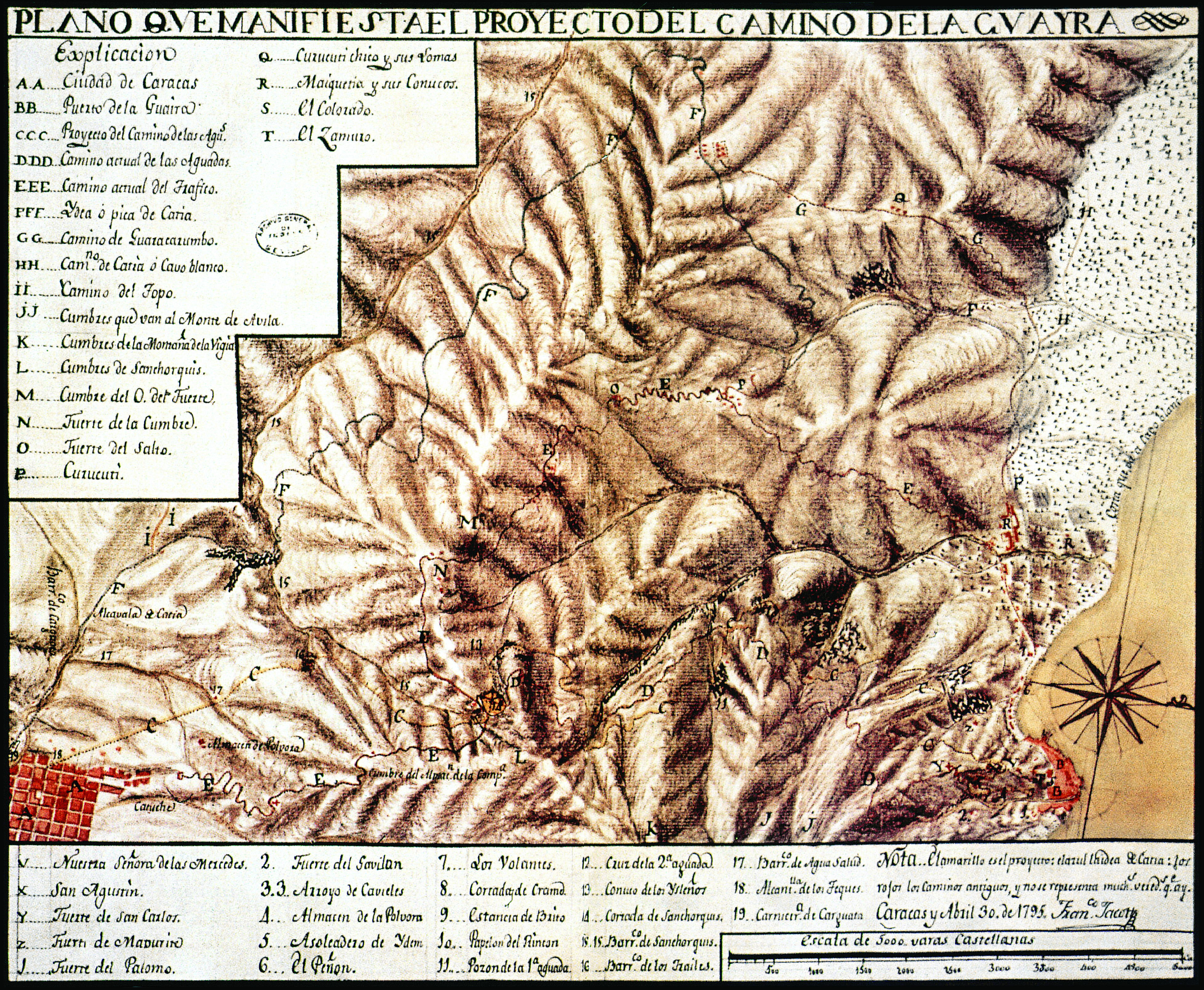
Mapa antiguo con el camino entre Caracas y La Guaira. EA-06
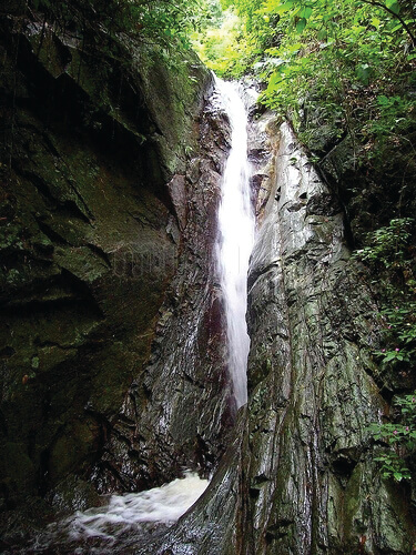
Una de muchas quebradas, quebrada Quintero. EA-08
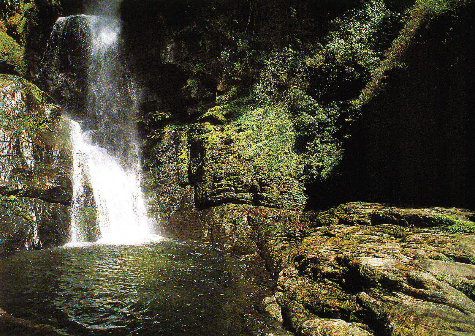
Una de muchas quebradas, quebrada Quintero. EA-07
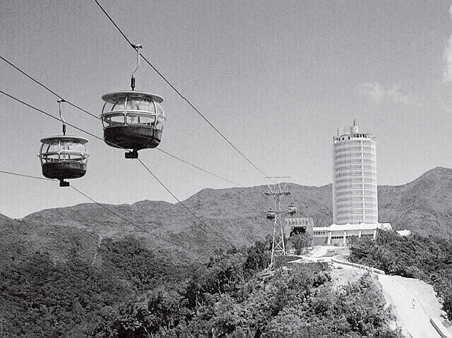
Funiculares entre la estación y el hotel Humbolt, años 60. FFU