
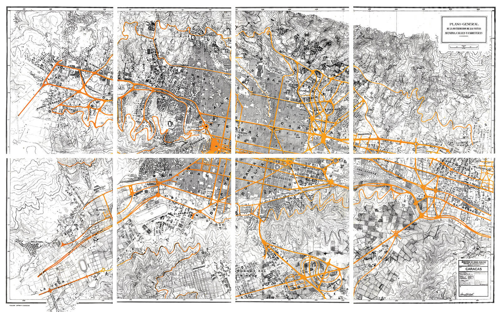
Caracas new avenues, streets and highways plan, 1938. Ministerio de Obras Públicas.HC-45

Winds of renewal
As Irma de Sola points out, «with the setting of a new political regime, in all sectors of Venezuelan life one felt the airs of renewal resulting in facts and ideas witnessing the quest for being up to date in all that hade been paralyzed for years». 1
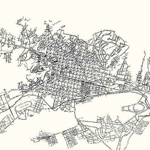
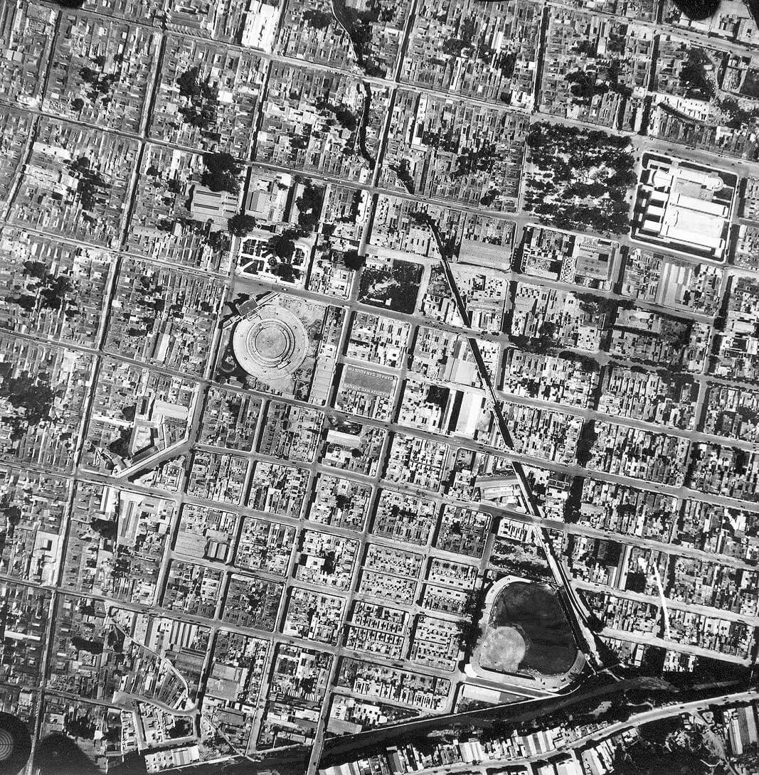
In 1938, Maurice Rotival submits a project for preliminary studies on the distribution of the new avenues, streets and roads. Urbanism actions at downtown and the logics of road structures for the valley and its surroundings, confirm the vision of a monumental city at its foundational nucleus and with new peripheral settings. In fact, with his proposal he reaffirms the importance that the road structure acquires between a modernized central area and the new urban peripheries being added and which are suggested as opposed to the density and intensity of the downtown metropolitan use. The plan of future circulation with the new avenues and streets proposed by Rotival submits the substitution of the bidirectional grid of its foundation, one that had been developed during almost four hundred years, by a linear axis going from east to west, linked to the urban peripheries through a series of ranked roads supported by the setting of rotundas or articulating nodes as a mechanism for the basting of fragments dispersed throughout the territory.
The design of a new city, differing from the original grid, is fully confirmed with the Haussmann minded notion of demolishing an important set of blocks of the original downtown area and with the introduction of a series of diagonals that, following the example of other important cities, establishes a connection between downtown an the peripheral areas. However, as a difference with the logic set by the the city’s foundational grid, the urban structure resulting from the 1939 Rotival plan, far from organizing the whole area where it operates, as was his original intention, will turn into a development by aggregation of several agricultural spots, linked to east-west directional axes having violent frontiers in their relationship or tissue with their immediate borders, thus generating discontinuities and frictions where their grids and elements meet. The plan does not contemplate the city’s continuation through its grid’s extension, but the creation of a new urban center in its foundational grid whose extension will be achieved starting from road infrastructure operations making it possible to connect that urban center with the new peripheral urban settlements.
With the new monumental axis, the city’s expansion through the valley is confirmed, as well as is the recognition of new peripheral settings being its satellites. 2
CAPTION
- De Sola Ricardo Irma. Contribution to the studies of Caracas Plans. P. 164.
- Text by Nancy Dembo, José Rosas Vera and Iván González Viso.
HC-44
FFU

HC-46